Teaching H1 Geography can feel like balancing a map in a storm — you have the syllabus, the deadlines, and a room full of students who might see the subject as “just memorising facts.” But Geography is alive. It’s in the air they breathe, the news they scroll, and the city streets they walk daily. The challenge? Making them see it.
This playbook is packed with creative, exam-focused strategies to transform dry lessons into dynamic experiences that spark curiosity, deepen understanding, and keep students engaged long after the bell rings.
Understanding the H1 Geography Landscape

Before we jump into fancy teaching strategies, it’s important to know the “terrain” you’re working with. Think of this as reading the map before starting your journey. The H1 Geography syllabus has its own twists and turns — and if you don’t understand where students are coming from, it’s easy to lose them halfway through the lesson.
What the Syllabus Focuses On
H1 Geography zooms in on global and regional issues rather than exhaustive physical geography. Students explore:
- Climate Change & Variability – scientific causes, global impacts, local adaptations
- Sustainable Development – managing growth without exhausting resources
- Urban Challenges – housing, transport, environmental quality
But the real challenge lies in how they apply this knowledge:
- Interpreting and analysing graphs, maps, and photographs
- Linking concepts to case studies from Singapore and beyond
- Writing clear, evaluative arguments under timed conditions
💡 Tutor insight: Many students collect too many case studies. The goal is to help them choose a small, versatile set they can adapt to multiple questions.
Common Student Struggles

- Overestimating Ease – Some assume H1 = easy, and end up shocked by the workload.
- Weak Real-World Application – Knowing definitions, but struggling to tie them to examples like Bukit Timah Nature Reserve for biodiversity or Tokyo’s transport system for urban planning.
- Essay Structure Problems – Students often “content dump” instead of building a logical, exam-friendly argument.
“I studied everything, but still didn’t score” usually means poor question focus, not lack of effort.
Where Traditional Teaching Falls Short
Many lessons still follow a note-heavy, lecture-first format. This can cause:
- Passive learning — students hear but don’t process
- Weak retention — facts vanish after the test
- Low confidence — they’ve “learned” content but can’t apply it
A more effective approach is to weave active learning moments — debates, role-plays, quick analysis drills — into every lesson so students practise thinking like a geographer, not just memorising like one.
Principles for Creative, Exam-Ready Lessons

Creativity in H1 Geography teaching is like adding seasoning to a dish — too little, and lessons feel bland; too much, and you lose the main flavour. The sweet spot is fun enough to spark curiosity, but focused enough to boost exam performance.
Think of these principles as your compass to make sure every creative idea still keeps students moving towards that A.
Align With MOE Requirements
The MOE syllabus isn’t just a guideline — it’s the rulebook.
Every creative activity should directly reinforce assessed skills such as:
- Understanding and applying key concepts
- Analysing data from graphs, maps, and photos
- Writing well-structured, evaluative essays
💡 Tutor tip: Before running an activity, ask: If this exact skill came up in Paper 1, would my students be better prepared? If the answer is “not really,” tweak it until it is.
Adapt to Different Learning Style

No two students learn the same way. A strong lesson plan caters to:
- Visual learners → diagrams, annotated maps, mind maps
- Auditory learners → debates, group discussions, verbal walkthroughs
- Kinesthetic learners → hands-on activities like plotting on maps or mini fieldwork exercises
Example: When teaching urban heat islands, combine a short video (visual), a discussion on local examples (auditory), and a quick temperature mapping activity (kinesthetic).
Set Clear, Measurable Objectives
Creative lessons need structure. Instead of saying:
“Today we’re learning about sustainable development.”
Try:
- “By the end of this lesson, you’ll be able to explain three strategies for sustainable transport and apply one to a Singapore case study.”
Clear targets help:
- Keep the class focused
- Make progress easy to track
- Show students exactly what success looks like
Classroom Strategies That Capture Attention

H1 Geography may not have the breadth of H2, but it still needs energy in the classroom. The trick is to turn “passive note-taking” into active exploration, where students actually want to participate instead of watching the clock.
Here are four strategies that work well with Singapore’s syllabus — and keep your lessons lively without losing exam focus.
Storytelling With Case Studies
Case studies are more than “just examples” — they’re the stories that make Geography stick.
Instead of saying, “Singapore is prone to flash floods due to high rainfall and urbanisation,” tell it as:
“Imagine leaving school on a sunny afternoon, only for a sudden downpour to flood the Orchard Road underpass…”
This narrative approach:
- Helps students remember details longer
- Creates emotional connection to the topic
- Makes facts easier to recall under exam stress
💡 Tip: Tie stories to recent events in Singapore or the region so they feel relevant.
Gamifying Revision and Practice
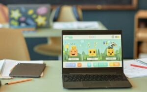
A bit of friendly competition can turn even the driest topics into something students look forward to. Examples:
- Geo-Jeopardy for quickfire revision
- Case Study Bingo where students match scenarios to examples
- Timed “data race” where teams analyse a graph under time pressure
Gamification works best when:
- The scoring rewards accuracy over speed alone
- The questions mirror actual exam formats
- Students can see immediate feedback
Interactive Map and Data Skills
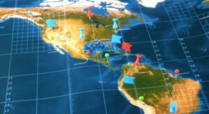
Geography without maps is like kopi without sugar — possible, but less satisfying.
Instead of static diagrams, get students to:
- Annotate blank maps from memory
- Overlay climate data on population density maps
- Use online tools like Google Earth to “fly” to locations in real time
This strengthens:
- Spatial thinking
- The ability to connect physical and human geography
- Speed in interpreting exam map-based questions
Role-Playing Real-World Stakeholders
Debates come alive when students take on actual roles. For example:
“You’re an environmental NGO representative arguing against the government’s plan to build a new coastal highway.”
- Practise persuasive argumentation
- See geographical issues from multiple perspectives
- Understand the trade-offs in real-world decision-making
💡 Tutor insight: Always debrief after the role-play. Link the arguments back to syllabus concepts so students see how it could score marks in an essay.
Making Concepts Tangible

Some H1 Geography concepts can feel abstract — climate variability, urban microclimates, sustainable city design. The fastest way to make them “click” is to let students see, touch, or create something with the concept instead of just hearing about it.
Here are three ways to bring textbook ideas into the physical (or virtual) world.
Data Visualisation Projects
Numbers in a table can be intimidating, but turn them into a chart or infographic and suddenly, trends jump out.
Have students:
- Convert raw rainfall or temperature data into line graphs
- Use colour-coded maps to show population changes
- Create infographics explaining a case study in one page
Why it works:
- Improves data interpretation speed (key for DRQs)
- Encourages summarising skills instead of memorising chunks of text
- Lets visual learners shine
💡 Tip: Encourage free online tools like Canva or Google Sheets so they can replicate the skill during self-study.
Fieldwork Simulations Indoors

Not every school or tuition centre has the budget or time for actual field trips — but you can still create mini fieldwork activities in class. Examples:
- Urban land use survey using printed aerial photos of Singapore’s CBD
- Flood risk mapping with simplified topographic maps and markers
- Traffic flow observation using short video clips of real intersections
Benefits:
- Gives students a “hands-on” sense of how geographers gather data
- Makes them more comfortable with map-based and fieldwork-style questions
- Builds problem-solving skills in a controlled environment
Hands-On Experiments and Models
Small-scale models are perfect for making physical geography less abstract.
You could:
- Use sand and water trays to show coastal erosion
- Build a cardboard cross-section of an urban drainage system
- Simulate heat absorption using dark vs light surfaces and a heat lamp
These activities:
- Turn theory into something visible and memorable
- Encourage questions (“Why did the sand shift this way?”)
- Break the monotony of purely paper-based lessons
💡 Tutor insight: Keep experiments short (10–15 minutes) and tie them directly to a past-year exam question so students immediately see the relevance.
Leveraging Technology for Engagement

Technology can turn Geography lessons from “static notes” into immersive experiences. With the right tools, you can take students out of the classroom without leaving their seats, collaborate in real time, and bring abstract data to life.
Virtual Field Trips and 360° Exploration
Not every school can organise overseas field trips, but with platforms like Google Earth, National Geographic VR, or YouTube 360°, students can:
- Explore the Amazon rainforest canopy
- Walk through Singapore’s Marina Barrage
- View coastal erosion at England’s Jurassic Coast in real time
Benefits:
- Makes learning feel like an adventure
- Provides visual context for case studies
- Lets students “visit” locations multiple times for revision
💡 Tutor tip: Pair the virtual tour with a short DRQ exercise so students practise extracting data from what they see.
Collaborative Digital Projects

Group work doesn’t have to mean huddling over one sheet of paper. Using online tools like Google Slides or Padlet, students can:
- Build a shared map of global climate anomalies
- Curate case study boards with images, facts, and videos
- Comment on each other’s work in real time
This promotes:
- Peer learning
- Organised, accessible revision resources
- Accountability, since contributions are visible to all
Recommended Free and Paid Tools
Free:
- Google Earth – 3D exploration and custom map creation
- Canva – Quick, attractive infographics for case studies
- Padlet – Interactive boards for class brainstorming
Paid:
- ArcGIS Online – Professional-grade mapping and analysis
- Thinglink – Interactive image and video annotations
- Nearpod – Customisable interactive lessons with quizzes
💡 Tutor insight: Start with free tools to test engagement. Once students respond well, consider investing in paid options for richer features.
Connecting Geography to the Real World

Geography comes alive when students see it unfolding beyond the classroom.
When concepts are tied to current events, real people, and everyday observations, students stop asking, “Why are we learning this?” and start making their own connections.
Using Current Events as Teaching Anchors
The news is full of ready-made Geography lessons:
- Urban heat waves in Singapore
- Typhoon impacts in the Philippines
- Drought and water rationing in Australia
By linking a lesson to a current headline, you:
- Make abstract concepts tangible
- Show students Geography is happening now
- Provide fresh, relevant examples for essays and DRQs
💡 Tutor tip: Keep a shared “Geography News” folder or WhatsApp group so students can drop in articles they find interesting.
Inviting Guest Speakers or Industry Experts

Sometimes, hearing from someone in the field can spark more curiosity than a dozen slides.
Possible guests include:
- Urban planners from URA
- Environmental scientists
- NGO workers involved in disaster relief
Benefits:
- Students hear first-hand experiences
- Gives depth to case studies
- Opens career-related discussions
💡 Even a 20-minute Zoom Q&A can be more impactful than a full lecture on the same topic.
Encouraging ‘Geography in Daily Life’ Observations
Geography is everywhere — the MRT map, the way HDB blocks are oriented, even the afternoon rain pattern.
Encourage students to:
- Keep a “Geography diary” of observations and photos
- Share quick examples during class
- Relate syllabus concepts to local places they visit
This habit:
- Strengthens application skills
- Makes revision easier (personal examples are easier to remember)
- Builds the “Geographer’s eye” for spotting patterns in the real world
Conclusion — Creating Lessons That Stay With Students

Great H1 Geography teaching is more than covering the syllabus — it’s about making the subject memorable, relevant, and exam-ready.
When you:
- Ground lessons in MOE requirements
- Mix creativity with clear objectives
- Use tech, real-world connections, and hands-on activities
…you give students more than just facts. You give them skills and perspectives they’ll carry long after the paper is over.
💡 Start small. Pick one new strategy from this playbook, try it in your next class, and see how your students respond. The more you experiment, the more you’ll discover that in Geography — and in teaching — the best journeys are the ones that come alive.
